Interactive Map
An interactive map of the proposed boundary is available here:
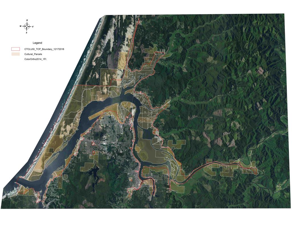
Instructions for using the map
1. On the left side of the screen under “Details” are three icons. Click on the middle icon of a square (“Contents,” to the right of the i for “Information” icon. A menu will appear once that icon is clicked showing options for things you can view on the map (“Coos Buildings,” “Coos County Zoning,” etc).
2. Click only the following boxes (uncheck any others): “Proposed Traditional Cultural Prop” and “February 2019 Parcels.”
3. Use the + and – buttons on the lefthand corner of the map to zoom in and out of the map. As you zoom in towards Coos Bay and North Bend, you should see an outline of the boundary of the proposed zone in grey/blue with a red outline. Keep zooming-in towards your property until you can yellow lines delineating the tax lots.
4. Click on your tax lot – it will display the name of the owner, the tax lot number, and other information. The information listed under “Owner 1” will match the Property Owner List.
5. If even a small portion of your lot is inside the grey/blue zone, then your property is in the proposed zone and you are an affected property owner with standing to object.